


|
Directions from BOSTON
*I-90 W/MASS PIKE/MASSACHUSETTS TURNPIKE
*I-290 E/I-395 S, EXIT 10, toward US-20/WORCESTER/OXFORD.
*I-395 S toward NORWICH CT.
*RT-16 E exit, EXIT 2, toward DOUGLAS.
*Turn SLIGHT LEFT onto E MAIN ST/MA-16/GORE RD. Continue to follow GORE RD.
*GORE RD becomes LOWER GORE RD.
*RIGHT onto LAKESIDE AVE.
*RIGHT onto WAKEFIELD AVE.
*RIGHT onto HALL RD.
*LEFT onto BATES POINT RD.
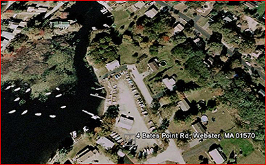
*4 BATES POINT RD is on the RIGHT.
Directions from HARTFORD
*I-84 E toward BOSTON
*I-90 E/MASS PIKE/MASSACHUSETTS TURNPIKE toward N.H.-MAINE/BOSTON
*I-290 E/I-395 S exit, EXIT 10, toward US-20/WORCESTER/OXFORD.
*I-395 S toward NORWICH CT.
*RT-16 E exit, EXIT 2, toward DOUGLAS.
*SLIGHT LEFT onto E MAIN ST/MA-16/GORE RD. Continue to follow GORE RD.
*GORE RD becomes LOWER GORE RD.
*RIGHT onto LAKESIDE AVE.
*RIGHT onto WAKEFIELD AVE.
*RIGHT onto HALL RD.
*LEFT onto BATES POINT RD.
*4 BATES POINT RD is on the RIGHT.

|
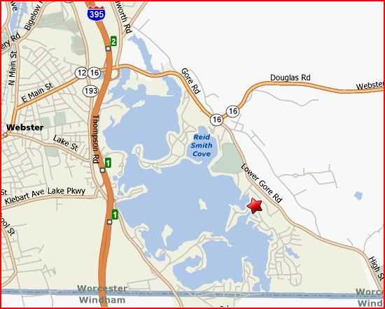
Printable Webster Lake Map
|
|